Are you one of those people, who can’t tell which way is north, without a compass?
So you are hiking in the wilderness and things go incredibly wrong. At first you just notice that you do not quite recognize your surroundings.
You might keep going in the same direction, or you might try to retrace your steps.
| Quick Navigation 1. Tech Devices 2. Maps and Landmarks 3. Using the Sun and Stars 3.1.Shadow 3.2. Wrist Watch 3.3. North Star 4. Building Your own Compass 5. Blazing a Trail |
Unfortunately, in most cases you will be heading further away from the trail and further into the wilderness. You’ll start to pick up the pace which most often makes things worse.
Finally, you realize you are completely lost and must try to plan a route to get back to safety, but you forgot to pack your compass. Your life is now in danger.
But do not panic. When you lose your cool, you typically do not move in a logical direction. This just makes things worse. Stay calm and come up with a logical plan to get where you need to be even without a compass!
Here are some methods that you can try to help you get back to the trail:
1. Tech Devices
Let’s get this one out of the way right upfront. Yes, having a cell phone or a GPS device can get you to safety. Most phones have the ability to track your location on a satellite image. However, these devices can get wet, can be broken, or can lose signal.
Satellite images and GPS work by receiving a signal directly from a satellite in space. This means that anything between you and that signal can shut the device down.
It could be trees, mountains, or even heavy clouds. Do not rely upon technology to save you, but certainly use it if you have the capability.
2. Maps and Landmarks
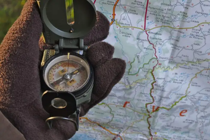
If you have a map but do not have a compass, you can still potentially find your way. Both topographical and road maps often have landmarks on them such as mountains, bodies of water, trails, and roads. Your first step is to get to a high point from which you can see a long way in all directions.
It could be a mountain peak, a hilltop, or you could even climb a tree. Note down where you see these landmarks in the area. You will need to see at least two landmarks to orient your map.
Estimate your distance to each landmark and then find the landmarks on your map. Rotate the map until you have your estimated distances right, and then triangulate your rough location.
From there you should be able to determine the best general direction in which to travel. Your goal is to get to a linear landmark that will guide you back to safety such as a road, trail, river, stream, or shoreline.
You can also use landmarks to navigate without a map. In order to do this, you need to note the location of landmarks before you leave the trail.
They should be large enough that you can see them from a distance. If you get to the point at which you feel like you are lost, get to a high area and locate those same landmarks.
This should give you an idea of where you need to head to get back to where you left the trail.
For example, you notice before you leave the trail to the North that there is a mountain peak to the NW and a tree taller than all of the others to the South just off the trail. You head north for about a mile and notice you are lost.
The mountain peak is now directly to your left and the tree is directly behind you.
At this point, you can turn back toward the tree with the peak on your right and start walking towards the tree. As you walk towards the tree, you should notice that the peak will move from directly to your right to slightly behind you and to your right. This should roughly take you back to the point where you began.
3. Using the Sun and Stars
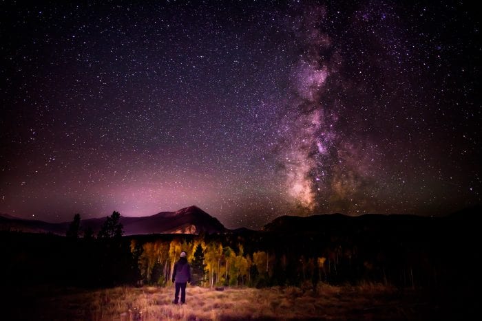
The sun and stars have been used for land navigation for thousands of years. If you find yourself lost without a compass, this could be your best bet. Obviously, the sun rises in the East and sets in the West.
This can give you a general method for navigation. For example, if you want to travel North and the sun just rose you can keep it directly to your right and you will be moving in the correct general direction.
However, there is a more accurate way to use the sun.
3.1.Shadow
- Stick a stick or branch into the ground
- Put a rock, or other marker, on the tip of the shadow, cast by the stick.
- Wait
- In a while (15 minutes or more) the Shadow will have moved. Draw a line between the rock, or other marker, and the current tip of the shadow. That line points East and West. The Rock, or first marker indicates West and the current tip of the shadow indicates East.
3.2. Wrist Watch
You can use your watch to determine direction. These are the direction, for those of us, in the Northern Hemisphere! If you are in the Southern Hemisphere, then your half-way point will be pointing North instead of South!
- Find the sun. If you look up and see a flaming ball in the sky, this could be the sun
- Point the hour hand (the little hand), on your watch at the sun.
- Locate the half-way point between the hour hand and 12.
- That half-way point will be pointing South.
Even if you only have a digital watch, you can still use this same method. Just imagine where the hour hand would be if you this was an analog watch, then follow the same procedure.
3.3. North Star
Polaris, the North Star, Sits above the North Pole. In the Northern Hemisphere, it can be located using the Big Dipper Constellation.
- Locate the Big Dipper
- Mentally Draw an imaginary line through the 2 outer stars that make up the “bowl” or “cup” of the Dipper. (These 2 Stars are named Merak and Dubhe)
- Follow this imaginary line straight (about 5 times the distance between Merak and Dubhe)
- Bang! There’s the North Star, Polaris!
4. Building Your own Compass
Even without a compass you can build your own to find magnetic North.
 You will need a container of some kind that will hold water. This could be a cup, a pot, or you could cut open a bottle or can.
- You will also need an item that floats such as a cork, a piece of rubber, a piece of styrofoam, or a dry leaf.
- Also, you need a thin, straight piece of metal along with a larger piece of metal. The small piece could be a straightened paperclip, a pin, a small nail, or a piece of wire. The larger piece could be any type of tool or hunk of metal. You want to rub the large piece on the small piece or strike them together. This should magnetize the small piece. Fill the container with water and place the float in the center.
- Put it on flat ground and place the small piece of metal on the float. Give it a few minutes to rotate, and it should settle on your North/South line.
5. Blazing a Trail
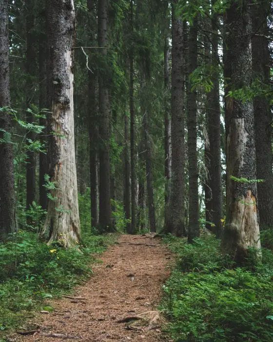
If you are going to leave your primary trail, there are precautions you can take to ensure you can find your way back. The best option is to blaze a trail.
This is the process of leaving a series of markers along your path that you can follow to retrace your steps. It also can give rescuers a way to find you if needed. The most common way to do this is to use a knife, hatchet, or machete to chop a piece of bark off of a tree every 20 to 30 yards.
This exposes the lighter wood underneath leaving a noticeable marking. I have also seen people use brightly colored tape or cordage to tie on branches.
Using something brightly colored means that your markers can be seen from a longer distance and be further apart, but the tying process tends to take longer than chopping off some bark. Either way, you are being prepared by giving yourself a definite path back to safety.
If you are one of the lucky people, who has an internal compass, congratulations! Make sure you don’t grow complacent. Navigation and direction-finding are skills you must constantly use, or you may lose them!
And, just an extra layer of precaution. Maps (like the Delorme Atlas Gazetteer), Compasses and GPS are great tools to have and to know how to use the next time you plan to get lost in the woods.
Bonus: How to Buy the Right Compass
I recently lost my very last compass, and I’m glad.
This compass was very inexpensive Coghlans Map Compass. I purchased this compass at the surplus store, en route to a camping trip. It was only supposed to hold me over, until I could order a replacement, for the Suunto compass that I had recently lost. It seems that I might be the equivalent of a Bermuda Triangle for compasses.
The Coghlans Compass ended up as my primary compass longer than originally planned, and I used the heck out of that compass.
I didn’t have high expectations for the Coghlans Compass, but the compass needle tended to point in a Northerly direction and that was good enough in a pinch. I did find myself missing some of the features and high quality of that lost Suuntu compass.
On a positive note, I am confident that the woodland creatures are appreciating the quality construction of that compass…
Desired Features
I started keeping a list of features that I needed (ok, wanted) on my compass wish list.
When I finally lost the Coghlans Map Compass, I pulled out my wish list of compass features and started digging around the Amazon marketplace for my upgrade.
Wish List (these are my actual notes, but sanitized and curse words removed)
- Illuminated (or glow in the dark) dial and needle – I must have this on any compass from now on!!!
- clear and efficient markings without too much clutter
- adjustable declination (or declination adjustment) – I think the lack of declination is why I am lost.
- Raised and Beveled edges, to can easily rotate the compass for correct bearings, with gloves on. (aka: I am not taking off my gloves, it’s too cold, I’ll just stay lost a while longer)
- must not cost a trillion bucks…maybe $30
That’s a pretty simple list. What do you expect from a man stopping to scrawl notes on compass features, while lost in the forest?
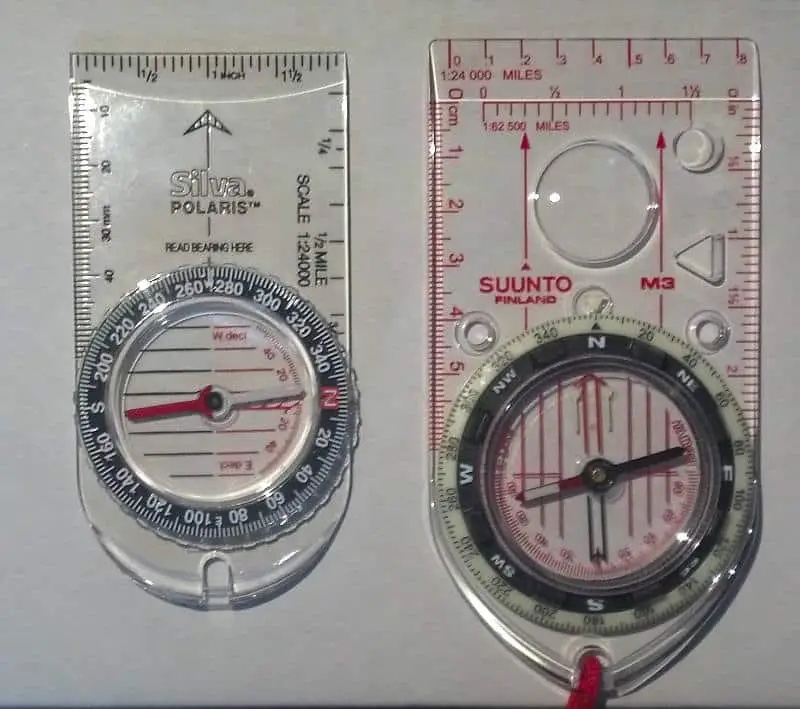
There were dozens of compasses that met my requirements, but item #5 (price) really trims the competition down. I finally opted to go with another Suunto, the Suunto M3, because I really appreciate the quality of the Suunto compasses.
The Suunto M3, matched my wish list perfectly and it was even snazzier and better constructed than the last one. These fine compasses are constructed of quality materials and are made in Finland (not China!) and should last me a long time.
I’m sure I’ll lose it on some upcoming hike, outing or camping trip, so to hedge my bets, I also purchased a back up compass, a Silva Polaris compass, which is the official Compass, of the Boy Scouts.
Even If I lose my primary compass, I won’t be stuck buying another Coghlans Compass, on my way to a camping trip again. Don’t get me wrong. I’ll take any compass over no compass any day!
Finding the right compass was a pretty simple task this time around since I had made a list of what I really wanted. Everyone should keep a notebook in their backpack to take notes of any likes, dislikes or lacking features for any piece of survival or camping gear in your kit. That way when it comes time to buy a new piece of gear, you have a place to start.
You really can’t go wrong with a Suunto compasses and the Suunto M3 has a sweet price point, that does NOT compromise the quality of the construction. It’s rugged and the right size and will fit perfectly in my navigation kit… until I lose it.

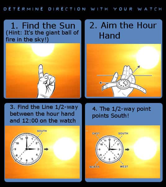


I love number one on determining direction with your watch…”Find the sun. If you look up and see a flaming ball in the sky, this could be the sun…” A calm funny… 😉
Copyright © GeekPrepper.org Read more at: https://www.geekprepper.org/methods-to-determine-direction/
I was running a course on field craft a number of years ago and in a test asked trainees to detail a way to determin direction using a watch. One answer was that you tie a piece of string to the watch, swing it around your head until its going real fast then let go the string. Your watch is said to have gone west!
In southern hemisphere you use southern cross instead of big dipper, you can use spider webs tend to be out south side of trees (not latitude), and if near body of water birds fish and amphibians tend to breed on west side, highest clouds tend to move west to east, travelers palm its very likely the axis of there branches run west to east, moss is usually most lush on northside of tree in northern hemisphere and southside in southern hemisphere,puddles of water are same as moss, and tree stumps tend to be the opposite of water and moss. I mean yea there not 100 percent acurate but nothing is i mean a compass can act up near a magnetic field gps fritz etc